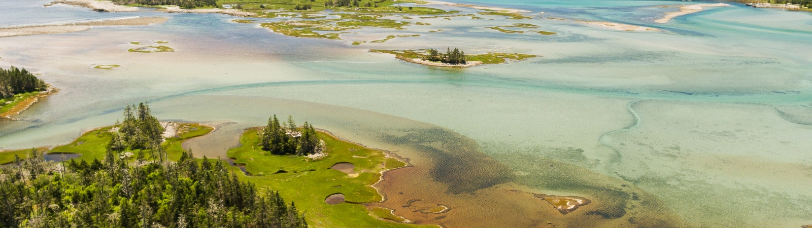
Nova Scotia, known as Canada’s Ocean Playground, is an Atlantic province defined by 13,300 kilometers of coastline. Around 70 per cent of the population live in coastal communities and approximately one-fifth of our province’s economy is supported by coastal and marine industries. Our spirit, our music, our recreation, and our culture are very connected to our coast.
Unfortunately, we are facing the most extreme sea-level rise predictions in the country, due in part to vertical land movement (our land is subsiding as the sea-level rises). We have some of the highest tides in the world along the Bay of Fundy shore. Nova Scotia is located on the path of hurricanes and post-tropical storms travelling up the Eastern Seaboard and we regularly experience extreme weather events. Coastal climate change is significantly impacting our province. We are seeing storm surges and coastal flooding, accelerated coastal erosion and saltwater intrusion.
More Information & Resources
More Information & Resources
The Educating Coastal Communities About Sea-level Rise (ECoAS) Project is an initiative designed to translate scientific climate change research into useable information to educate coastal communities within Atlantic Canada about the need for planning for future sea-level rise impacts. The EAC teamed up with Fisheries and Oceans Canada to create an informative website brimming with resources for coastal residents, fishers and municipalities about rising seas in Atlantic Canada and British Columbia.
The Project Aims to:
-
Help communities learn about sea-level rise and how it affects them
-
Provide access to tools and resources that have been developed locally with the latest climate change information available
-
Illustrate where sea-level rise impacts are happening through an interactive map
-
Show the need for incorporating sea-level rise into future planning
Perceptions of Sea-Level Rise:
-
The EAC partnered with students in the Department of Sociology and Social Anthropology at Dalhousie University to look at the perceptions of residents and students on sea-level rise. By understanding perceptions, we can focus our actions on the underlying barriers that prevent people from planning for, and adapting to, sea-level rise. The findings include: Perceptions of sea-level rise: An exploratory research project, Diving deeper into public perceptions of sea-level rise, and Drops in a bucket: Halifax residents’ Perceptions of Sea-Level rise
Learn More About Sea-level Rise:
- On our website: www.sealevelrise.ca
Living Shorelines
Living Shorelines
Many coastal property owners in Nova Scotia are concerned about property loss or damage due to erosion (sediment movement caused by water and wind). Traditionally, boulders, rock, wood, and steel walls have been used to reduce property loss. But this type of hard infrastructure can be expensive, require regular maintenance, and even interfere with sediment movement and beach formation, increasing erosion elsewhere along the coast.
Living Shorelines are a softer approach for stabilizing shorelines.
Used extensively in the United States and Europe, they can help slow down erosion and create resilient shorelines to better withstand waves and storms. Living Shorelines approaches are diverse, but they all seek to mimic natural processes, which help a coastline to reach a more stable state. A variety of coastal ecosystems, such as oyster reefs and eelgrass meadows in shallow waters, salt marshes in the intertidal zones, beaches, dunes, vegetated slopes, and upland coastal forests all offer their own unique style of erosion and flood protection, often referred to as ecosystem services. They also all improve water quality and habitat value for a diversity of coastal species.
Check out our Living Shorelines Toolkit!
We developed customized information-based tools to help coastal property owners and coastal professionals apply Living Shorelines principles and approaches in Nova Scotia. Below, you’ll find some relevant internal and external resources on Living Shorelines.
Do you want help developing a Living Shoreline for your coastal property? Contact Helping Nature Heal, an ecological landscaping company that has adapted the Living Shoreline approach to Nova Scotia’s unique coastal ecosystems. They have worked on many Living Shoreline projects across the province!